4.2.1. The master plan for the territory of a production (industrial) facility should be developed in accordance with the requirements of the current regulatory documents.
4.2.2. The provision of a land plot for the construction of a chemical waste disposal facility is allowed if there are sanitary and epidemiological conclusions on their compliance with sanitary rules (Article 12 federal law dated March 30, 1999 N 52-FZ "On the sanitary and epidemiological well-being of the population").
4.2.3. An industrial site for the construction of new facilities should be selected taking into account the climatic characteristics, terrain, patterns of distribution of industrial emissions in the atmosphere, the potential for air pollution and background concentrations of pollutants in the area, downwind of residential, recreational and resort areas. Line location of all industrial buildings should be perpendicular to the direction of the prevailing winds.
4.2.4. The placement of the industrial site of the facilities is carried out taking into account the background indicators of sanitary and epidemiological well-being and if it is possible to organize a SPZ from the industrial site of the facility.
4.2.5. In accordance with SP 2.2.1.1312-03 "Hygienic requirements for the design of newly built and reconstructed industrial enterprises" in the territory industrial facility it is necessary to single out the administrative, economic, auxiliary, production and transport and storage zones. The industrial site should be installed within the boundaries of the land plot owned by the facility for maintenance economic activity in accordance with SanPiN 2.2.1/2.1.1.1200-03 "Sanitary protection zones and sanitary classification of enterprises, structures and other objects. New edition".
4.2.6. The territory of the XXO facility includes a military camp, medical and prophylactic institutions of garrison significance and a technical territory.
4.2.7. The territory of the military camp of the XXO facility, as a rule, consists of the main zones: barracks, park of equipment and weapons, residential, utility and warehouse. Medical and prophylactic institutions of garrison significance are located on an independent site in the hospital zone.
4.2.8. The territory of the production facility (industrial site) of the CWDF should include the main buildings and structures for the destruction of chemical munitions, storage, recycling and disposal of the products of the detoxification of agents, auxiliary buildings and structures, administrative buildings, storage facilities for the storage of raw materials and materials. Warehouses are located in separate one-story buildings, at a safe distance from the production facilities for the destruction of ammunition, administrative buildings and other structures, as well as possible sources of ignition.
The technical area of the HCS facility should include an arsenal for storing chemical munitions, facilities for the destruction of emergency chemical munitions or complexes for the destruction of emergency special products (hereinafter - KUASI), auxiliary buildings and structures, administrative buildings and premises.
4.2.9. The mutual placement of buildings and structures of the CWDF facility should provide favorable conditions for natural lighting of the premises and ventilation of the industrial site. It is forbidden to construct buildings that have forms that contribute to the formation of stagnant zones.
4.2.10. The dimensions of the site for the technical territory of the facility for CWDF and the industrial site of the CWDF facility should be sufficient to accommodate the main and auxiliary facilities, including dust and gas treatment and local treatment facilities, places for the collection and temporary storage of permitted industrial and domestic waste, as well as devices for the neutralization, disposal of waste and landfill (site) for waste disposal.
4.2.11. AT project documentation routes for transporting CW across the territory of the facility should be developed without crossing them by the main human flows with the implementation of measures that exclude the possibility of creating emergency situations.
4.2.12. As part of the industrial site of the facility, degassing points for road and rail transport should be provided in case of an emergency.
4.2.13. The industrial site should have a relatively flat surface and a slight slope to ensure the drainage of surface water. The site must have a low level of standing groundwater and be located in a flood-free area. The level of standing groundwater should be 0.5 m below the basement. If necessary, appropriate land reclamation measures should be taken to drain the construction area.
4.2.14. The territory of the objects of destruction of the chemical agent, free from buildings and passages, must be planted with trees and shrubs by at least 50%. All roads for vehicles and pedestrians must have hard, even surfaces with organized storm water drains.
4.2.15. Outside the production area of CWF facilities and the technical territory of CWF facilities, in the administrative and economic zone of the territory of the CWDF facility and in the territory of the sanitary protection zone of the above facilities, it is allowed to place production canteens with daily storage of food products to provide working personnel employed in work with harmful conditions labor, medical and preventive nutrition.
4.2.16. The medical health center is located in the administrative and economic zone of the industrial site of the CWD facilities in the administrative building on an area of at least 500 square meters. m. medical care is located on the first floor of the administrative building.
The first aid station (by the type of resuscitation) is located in the main production buildings of the CWD facilities.
The rules for drawing up the general plans of the graphic part in the process of studying the course "Architecture of civil and industrial buildings" in addition to lectures and practical exercises include a lot of independent work of students on the development of architectural and structural projects of residential, public and industrial buildings under the guidance of a teacher.
The purpose of the course projects is the development of creative spatial
thinking with the development of skills for the development of space-planning, constructive,
engineering, architectural and compositional solutions using the latest
achievements of science and technology in the field of industrial construction.
Implementation of the master plan in the design of buildings for various purposes
is an important component in acquiring development skills not only
planning and constructive solutions buildings, taking into account their illumination, insolation,
ventilation, etc., but also buildings in general.
General plans (for educational purposes) are performed on a scale: 1:1000, 1:500, 1:250, 1:200, knots in 1:20 scale.
A wind rose is built on the master plan drawing(summer and winter) with directions
north in the form of an arrow with the letter "C" at the tip. The wind rose is placed in the upper left corner
drawing.
The master plan drawing is placed, taking into account the rules for drawing up general plans, on a sheet so that the long side of the territory boundary is located along the long side of the sheet, and the axes of the construction coordinate grid are parallel to the sides of the frame of the working field of the sheet. The top of the sheet should correspond to the northern side of the territory. A deviation from the orientation to the north within 90 degrees to the left or right is allowed.
The contours of the designed building are applied according to the axial dimensions adopted in the construction drawing, along the inner side of the contour line. On the contour of the building, door and gate openings are applied on a scale.
Inside the contour of the building indicate:
- building number according to the explication - in the lower right corner;
- the mark corresponding to the conditional zero mark adopted on
construction drawing.
Around the contour of the building, a blind area, entrance ramps, external stairs and
platforms at the entrances.
On the contour of the building show:
- coordinates of the points of intersection of the coordination axes of the building in its two
opposite corners, and with a complex configuration of the building or when it is not located
parallel to the axes of the building grid - in all corners. For cylindrical structures -
coordinates of the center and one characteristic point, as well as the diameter, for linear structures
- axis coordinate or coordinates of the beginning and end of individual sections;
- dimensional binding of the coordination axes of the building, structure to the center
the basis and dimensions of the building, structures between the axes in the absence of a building grid;
- designation (mark) of the coordination axes of the building, structure in coordinated
points.
The master plan must also show:
- roads, driveways with bindings or coordinates of their axes and curve radii in places
their intersections and junctions;
- sidewalks, footpaths with an indication of their width;
- sites for various purposes and their sizes;
- small architectural forms;
- trees, shrubs, flower beds and lawns.
The master plan drawing must be made in accordance with the conditional
graphic images and symbols according to GOST 21.204-93, some of which
given in table 8 below. This is included in the rules for the design of master plans.
On the drawing of the general plan, taking into account the design of the general plans, the following should be given:
1) List of residential and public buildings and structures according to form 1 or
explication of buildings and structures (for master plans of industrial enterprises
appointment) in form 2.
2) Technical and economic indicators:
- Plot area, m 2.
- Built-up area (the area attributable to all buildings and structures,
located on the site), m 2.
- Coverage area (the area attributable to roads, driveways, sidewalks, platforms
for various purposes with a hard coating), m 2.
— Landscaping area (the area attributable to trees, shrubs, lawns and
flower beds), m 2.
— Development coefficient (the ratio of the building area to the area of the site),%.
— Landscaping coefficient (ratio of landscaping area to site area), %.
— The coefficient of efficiency of land use (ratio of area
buildings to the area of the site), %.
3) Conventions elements of the master plan.
The master plan drawing can be supplemented with nodes and details of elements
landscaping: small architectural forms (decorative pools, fountains,
sculptures, pergolas, gazebos, etc.), structures of sidewalks, paths, platforms, etc.
Plan
Lecture 15-16
Topic 9 General plan of the enterprise. Requirements for buildings and structures.
General form state verification scheme
Purpose: to study the master plan of the enterprise and the requirements for buildings and structures.
1 Basic requirements for the master plan of the enterprise
2 Measures for environmental protection
3 Efficiency of land use
4 Basic requirements for buildings: functional feasibility, strength, fire resistance, architectural expressiveness, economy
5 Loads and their effects on the building and structure
6 Depreciation of buildings and structures
1. Antonov A. N. Fundamentals of modern organization of production: textbook / A. N. Antonov, L. S. Morozova. - M. : Business and service, 2004. -190 p.
2. Bolgov I. V. Infrastructure of service enterprises: a textbook for universities / I. V. Bolgov, A. P. Agarkov. - M. : Academy, 2008. - 284 p.
3. Fatkhutdinov R. A. Production management: a textbook for universities / R. A. Fatkhutdinov. - St. Petersburg. : Peter, 2006. - 496 p.
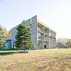
General plan - a plan for the location of all buildings, structures and devices on the construction site: storage, energy sites, transport routes, engineering and sanitary facilities, green spaces and fences, indicating the horizontal and vertical marks of the designed objects.
It is a plan of the land allotted for development.
Basic requirements for the master plan:
1 Fencing of the territory of enterprises and separately located objects is made of non-combustible materials.
2 Distances from the fence to installations, structures, industrial auxiliary and auxiliary buildings, equipment and tank embankments should be taken into account the possibility of free passage of fire trucks and the creation of a security zone, but not less than 10 m.
3 General plant facilities: management buildings, public catering (canteen blanks), health care, design bureaus, educational buildings, public organizations, cultural services and others should be located in the pre-factory zone of the enterprise at a distance of at least:
a) from buildings and structures of categories A, B and intermediate warehouses of flammable and combustible liquids - 80 m;
b) from buildings and structures of categories B - 30 m;
c) from intermediate warehouses of liquefied combustible gases - 100 m;
d) from commodity warehouses (parks) of flammable and combustible liquids - 200 m;
e) from piston gas holders of combustible gases - 150 m;
f) from gas tanks of constant volume and gas tanks with a water basin - 100 m;
g) from pipelines with explosive products - 50 m.
4 Distance from explosive objects to the border of the right of way of common railways should be taken at least 100 m, to the edge of the right-of-way highways general use - at least 50 m.
5 The distance from the fence of the territory of the enterprise to the tram tracks must be at least 30 m.
6 The territory of the enterprise should be divided into zones.
7 Production, auxiliary, storage areas of the enterprise should be divided into quarters.
The area of each quarter of the enterprise in the red building lines should not exceed 16 hectares with the length of one of the sides of the quarter not exceeding 300 m.
The distance between the red building lines of two adjacent quarters of the enterprise and zones is determined from the condition of placing roads, engineering networks, overpasses, green spaces, etc. between them, but should be at least 40 m.
8. The location of buildings and structures within the quarters of enterprises should provide good ventilation. The design of buildings of a complex (II, III and T-shaped) configuration inside the quarters, as a rule, is not allowed.
9. Vertical layout on the territory of the enterprise should prevent the ingress of products during emergency bottling from the sites of some objects to the sites of others, as well as ensure the organization of the removal of spilled products and atmospheric precipitation.
10. On the territory of enterprises for landscaping, trees and shrubs of only deciduous species that are resistant to harmful emissions from enterprises, with the exception of those that emit flakes, fibrous substances and pubescent seeds during flowering, should be used, placing them at a distance of at least 5 m from buildings, structures, fences of the territory , if the conditions for the protection of enterprises do not require a greater distance from the fence. In the zone of raw materials and warehouses(parks) only areas near amenity buildings and checkpoints should be landscaped.
11. When enterprises and warehouses (parks) of flammable and combustible liquids are located in a wooded area, as well as in areas of mass occurrence of peat, the distance from the border of the forest area and the area of mass occurrence of peat to the fencing of enterprises or warehouses must be at least:
for coniferous species and areas of mass occurrence of peat
for hardwood
Along the border of the forest area around the enterprise or warehouse (park), a plowed strip of land with a width of at least 5 m should be provided.
13. Enterprises and their raw materials and commodity warehouses (parks) of flammable and combustible liquids should be located at a distance of at least 200 m from the banks of rivers and, as a rule, downstream (downstream) of the piers, river stations, large roadsteads and places of permanent parking of the fleet, hydroelectric power plants, shipbuilding and ship repair plants, bridges, water intakes, at a distance of at least 300 m from them, if from these objects are valid for their design normative documents no further distance required.
When enterprises and their raw materials and commodity warehouses (parks) of flammable and combustible liquids are located higher (along the river) of these structures, they must be located at a distance of at least 3000 m from the latter.
14. Commodity warehouses (parks) of flammable and combustible liquids with a capacity of up to 1000 and 5000 m3, respectively, in chemical and petrochemical industries (at enterprises) should be located from buildings and structures that are not related to the warehouse, at distances provided for by the chapter SNiP "General plans industrial enterprises", and not less than 40 m from outdoor technological installations classified by fire hazard to categories A, B and C.
15. Distance from internal railway tracks to buildings and structures with industries of categories A and B c individual cases, under cramped conditions of the general plan of the enterprise, can be reduced to 10 m.
16. Railway tracks directly serving railroad production and storage buildings, with the exception of warehouses (parks) of liquefied hydrocarbon gases, flammable and combustible liquids, are located from these buildings according to the dimensions of the approximation in accordance with the chapter SNiP "General plans for industrial enterprises. Design standards".
17. It is allowed to arrange the inputs of railway tracks in all industrial premises, regardless of categories. The entry of steam locomotives, diesel locomotives and electric locomotives into the premises of category A, B and C is not allowed.
18. Stations for filling and storing oxygen cylinders should be located at a distance of at least 50 m from buildings and structures with industries of categories A and B.
19. Sanitary facilities (cloakrooms, showers) for commodity warehouses (parks) of liquefied hydrocarbon gases, flammable and combustible liquids should be located from the loading racks and storage tanks for LPG and flammable liquids at a distance of at least 60 m, from the loading racks and tanks flammable liquids - at least 40 m.
20. Sanitary facilities for explosive industries should be located in separate buildings or attached to buildings of category C, D, D.
It is not allowed to place assembly halls, red corners, canteens, health centers in these premises.
Distances from stand-alone sanitary facilities should be taken according to table 2, position 4. Attached sanitary facilities should be located at a distance of at least 18 m from an explosive outdoor installation and explosive premises.
21. Management production processes should be carried out from separate operator, central control points (CCP).
In justified cases, control rooms, central control rooms can be attached to rooms with explosive processes through an insert separating them with a width of at least 6 meters, in which non-explosive and fire hazardous rooms should be located without the permanent presence of production and maintenance personnel in them. The specified operator rooms, CPUs should only be used to control technological processes in the building to which they are attached and the equipment technologically related to this building installed in an open area.
Direct adjoining to premises with fire and explosion hazardous production processes is allowed only in the compressor room driver's room with the necessary devices.
22. The premises of TP, RU, RP, as a rule, should not be located in buildings with explosive and fire hazardous processes. Their placement in these buildings is possible only at the ends and through an insert separating them with a width of at least 6 meters, in which non-explosive and fire hazardous premises should be located without the permanent presence of production and maintenance personnel in them. Attached TS, RU, RP should serve only the technological installation within which they are located. Entrances to the attached transformer substations, switchgears, distribution centers should be provided, as a rule, from the end of the building. When arranging an entrance to an electrical room not from the end of the building, the distance from it to the external doors and windows of rooms with explosive processes must be at least 10 meters. The device of windows in electrical rooms is not allowed.
23. In production areas with explosive and fire hazardous installations in the areas of commodity warehouses of electrical premises (RU, TP, PP, RP), process control rooms must have floor marks, the bottom of cable channels and pits above the surface of the surrounding earth by at least 0, 15 m and have a guaranteed air pressure.
24. Laboratories in which work is carried out with flammable liquids, combustible liquids, combustible gases, located in buildings for other purposes, must be separated from neighboring premises by a blank wall with a fire resistance limit of at least 1.0 hours.
Fire risk assessment at a production facility
1. To determine the frequency of occurrence of fire hazardous situations at a production facility, information is used on:
failures of equipment used at the production facility;
reliability parameters of the equipment used;
erroneous actions of the personnel of the production facility;
hydrometeorological situation in the area where the production facility is located;
geographical features of the area in the area where the production facility is located.
2. The construction of fields of dangerous factors of a fire (explosion) for various scenarios of its development is carried out on the basis of a comparison of information on modeling the dynamics of dangerous factors of a fire in the territory adjacent to the production facility, and information on the values of dangerous factors of the analyzed fire (explosion) that are critical for human life and health ).
3. Assessing the consequences of the impact of dangerous fire factors on people for various scenarios of the development of fire hazard situations involves determining the number of people who have fallen into the zone affected by dangerous fire factors.
To assess the consequences of the impact of dangerous fire factors on people, both deterministic and probabilistic models of the development of fire hazardous situations and the impact of their dangerous factors on people are used.
4. The methodology and procedure for assessing the fire risk are established federal body executive power, specially authorized to solve problems in the field of fire safety.
Requirements for master plans of production facilities
Zoning of the territory production facilities
When designing production facilities, it is necessary to provide for the zoning of their territory according to the functional basis of the buildings and structures to be placed, taking into account technological connections and obligatory observance fire safety requirements. The specified zoning should be reflected in the master plans of production facilities, which are an independent section of the project documentation.
On a functional basis, the territory of the production facility should be divided into zones:
pre-factory (outside the fence or the conditional border of the enterprise);
production;
ancillary;
warehouse.
Other fire safety requirements for zoning the territory of production facilities are determined by this technical regulation and (or) regulatory documents on fire safety for the planning and development of cities, towns and rural settlements.
Placement of fire stations on the territory of industrial
objects
When creating fire departments on the territory of a production facility, fire stations to accommodate fire equipment and personnel of these divisions should be located on land plots adjacent to public roads.
The location of the fire departments on the territory of the production facility should be determined by calculation depending on the fire hazard of the protected objects and the purpose of the fire department’s departure to extinguish the fire, or be established based on the condition that the radius of the fire departments’ departure should not exceed 2 km.
Exits from fire stations should be located in such a way that exiting fire trucks do not cross the main traffic flows.
The number of fire trucks and the number of personnel of fire departments are established by the administration of the enterprise independently.
Requirements for roads, entrances and passages in the territory
production facility
Production facilities with sites larger than 5 hectares must have at least two entrances, with the exception of oil and oil products warehouses of categories I and II, which, regardless of the size of the site, must have at least two exits to motor roads of the general network or to the access roads of a warehouse or enterprise.
If the size of the side of the site of the production facility is more than 1000 m and its location along the street or highway on this side, at least two entrances to the site should be provided. The distance between the entrances should not exceed 1500 m.
Fenced areas within the sites of production facilities (open transformer substations, warehouses, etc.) with an area of more than 5 hectares must have at least two entrances.
Fire trucks must be accessible to buildings and structures along their entire length, on the one hand, with a building or structure up to 18 m wide and on both sides, with a width of more than 18 m, as well as when constructing closed and semi-enclosed yards.
For buildings with a built-up area of more than 10 hectares or a width of more than 100 m, the entrance of fire trucks must be provided from all sides.
In cases where production conditions do not require the construction of roads, it is allowed to provide for the access of fire trucks along a planned surface, reinforced 3.5 m wide at the passage points with clay and sandy (dusty) soils with various local materials with the creation of slopes that provide natural drainage of surface water.
The distance from the edge of the carriageway or the planned surface providing the passage of fire trucks to the walls of buildings up to 12 m high should be no more than 25 m, with a building height of over 12 to 28 m _ no more than 8 m, and with a building height of over 28 m _ not more than 10 m.
To reservoirs that are sources of fire-fighting water supply, as well as to cooling towers, spray pools and other structures, the water from which can be used to extinguish a fire, it is necessary to provide entrances with platforms for turning fire trucks of their installation and water intake with a size of at least 12x12 m.
Fire hydrants should be located along highways at a distance of no more than 2.5 m from the edge of the carriageway, but no closer than 5 m from the walls of the building.
Entrances for fire engines should not be provided for buildings and structures whose materials and structures, as well as technological processes, exclude the possibility of fire.
Crossings or crossings over intra-object railway tracks should always be free for the passage of fire trucks and have solid decks flush with the rail heads.
The width of the gates of car entrances to the site of the production facility should ensure unhindered passage of the main and special fire trucks.
Other fire safety requirements for the arrangement and parameters of roads, driveways and entrances on the territory of production facilities are established by special technical regulations and (or) fire safety regulations.
Requirements for sources of water supply in industrial
objects
At production facilities, external fire-fighting water supply should be provided. The source of water supply for a combined or separate external fire water supply system should be the city water supply network or water wells, and the source of water supply for a separate external fire water supply system must be water wells or surface water bodies. The network of integrated water supply should provide estimated flow water, taking into account household and drinking needs and fire extinguishing purposes. The arrangement of fire hydrants on the water supply network should ensure fire extinguishing of any building, structure or part of it served by this network.
In the project documentation submitted to expert opinion, includes the following drawings: layout plan, situational plan, reference plan, master plan, landscaping and gardening plan, relief organization plan, utility network plan. They are accompanied by a general explanatory note.
1. The general explanatory note should contain: - the main urban planning decisions on the general plan, the rationale for the adopted architectural composition, space-planning and constructive measures, decisions on transport services, relief organization, landscaping and landscaping, the system of servicing the population or workers; – main technological solutions; - ways to provide the facility with engineering networks, communications, engineering systems and building equipment; - fire and security measures; – solutions for energy efficiency and energy saving; – measures to preserve objects of immovable historical and cultural heritage and their territories; – measures for environmental protection; - the main activities for the organization of construction; - the main technical and economic indicators and data on the design capacity of the facility (indicators for pre-project and project documentation); – information about analogue objects (to determine estimated cost construction).
2. The location diagram shows: - the location of the object in terms of the city, district or quarter; - the name of the surrounding streets, passages, objects; - north-south direction.
For development projects, the layout of the projected territory in the structure of the city is carried out in the form of a development project.
3. On situational plan(topographic plan with underground utilities on a scale of 1:2000) are applied: - the boundaries of the site; – borders of territories of different functional purpose; - red lines, building lines, planning restrictions (boundaries of technical, water protection, sanitary protection zones, monument protection zones, etc.); - names of streets, passages; - existing preserved, demolished and designed buildings and structures, roads and driveways, green spaces, land use boundaries (including the opposite side of the streets and 100 m of adjacent territories) with the numbers of buildings (buildings) and their number of storeys; - north-south direction; - explication of buildings and structures.
4. On the base plan for building reconstruction projects, and for individual complexes on the topographic plan, they show: - the boundaries of the projected territory, indicated alphabetic letters in accordance with the initial permit documentation; - red lines, building lines, planning restrictions (building regulation lines, boundaries of technical and sanitary zones, protected areas); – existing green spaces; – the existing functional use of the territory within the boundaries of the project, as well as the adjacent territory within a radius of 100 m; - the existing building with the numbers of buildings (buildings), with the explication of buildings and structures, indicating the purpose, number of storeys, capital; - zones of protection of immovable monuments of history and culture, as well as the territory of objects of immovable historical and cultural heritage that do not currently have approved protection zones; – approved proposals for demolition, reconstruction of buildings and structures, decommissioning of enterprises, new construction; - existing streets, driveways, entrances to buildings; - north-south direction.
5. On the master plan (a topographic plan with underground utilities on a scale of 1:500) put: - the boundaries of the projected territory; – boundaries of territories of various functional purposes; – red lines and planning restrictions (development control lines, boundaries of technical and sanitary zones, protected areas); - names of streets, passages; - design functional use of the territory with the design boundaries of territories (plots) of residential, public, communal buildings, public green spaces, etc.; - preserved, demolished and designed buildings and structures indicating the number of storeys, building numbers, absolute floor level of the 1st floor, center axes and axial dimensions, entrances, entrances, pits, canopies of the designed objects; - maintained and designed roads, driveways and parking lots, indicating the width of intra-quarter streets, driveways, with markings of parking lots; - streets, driveways to buildings, fire lanes, loading and turnaround transport platforms; - green spaces, pedestrian paths and platforms with an indication of their purpose, the main elements of landscaping, taking into account measures for organizing the relief (locations of small architectural forms, fences, retaining walls, slopes); - the boundaries of the first stage of construction (with a phased implementation of the project); - north-south direction; - symbols.
The master plan drawing is accompanied by an explication and the main technical and economic indicators.
6. On the plan for the improvement and landscaping of the territory (on a scale of 1:500 on a copy of the general plan) show: - existing, preserved and planned green spaces - trees, shrubs, lawns, flower beds, etc.; - alleys, path network, small architectural forms, including fences, retaining walls, stairs, slopes, garbage collector sites and other landscaping elements; – borders of green areas of common use; – road surfaces; – existing and projected engineering networks; - a table of the range of planting material being designed and the amount of work on landscaping and gardening.
To coordinate projects, it is allowed to combine the landscaping and landscaping scheme with the master plan on a scale of 1:500 and show fundamental decisions - types of landscaping, pedestrian paths, sites indicating their purpose, the main elements of landscaping without scope of work.
7 On the relief organization plan (on a scale of 1:500 on a copy of the general plan) put: - the magnitude and direction of slopes, horizontal lines; - marks at the points of change of slopes; – storm water gratings with marks; - red and black marks on the corners of buildings, in front of the entrances; - structures of artificial surfaces, stairs, retaining walls; - absolute marks, corresponding to the conditional zero marks of the designed buildings; - slopes and retaining walls.
8. The technological plans indicate: - the main technological equipment; - vehicles; - categories of premises for explosion and fire hazard.
9. On the plans (on master plan) engineering networks show: - the boundaries of households; - existing and planned buildings, including heating points; - all existing portable and projected engineering communications.
10. On the plans of non-standard floors, the following is applied: - the coordinate axes of the building in characteristic places and the dimensions between them; - staircases; - elevator shafts; - walls and partitions, doorways with directions of their opening, window openings, stained-glass windows; - names of premises and their area, categories for explosion and fire hazard (in the absence of a technological plan); - cutting lines; - balconies and others architectural elements(if necessary).
11. Sections (longitudinal and transverse) are performed along the characteristic places of the building. They show: - overall dimensions of load-bearing and enclosing structures, stairs, ceilings; - entrances, window and door openings; - foundations and marks of the top and bottom of their laying; - relative marks by floors and marks of the adjacent relief; – composition of the coating structure; - the design of existing nearby buildings and structures.
12. The plans of engineering equipment and systems indicate: - the location of the main engineering equipment; – tracing networks in one line.
13. On the scheme of the construction plan, the following is applied: - fencing of the construction site; - location of household buildings; – temporary roads; - ways to move tower cranes; - storage areas building structures and materials; - connection points engineering networks during construction and temporary car washes.